Description
The Phi Phi islands are some of the most beautiful, and most popular, places to visit in Thailand. If you’re planning a trip here and want to see and do it all, I made this map for you.
Phi Phi is a group of six small islands in Thailand’s Andaman Sea between Phuket and Krabi. Of the six islands only the largest, Koh Phi Phi Don, is inhabited, while Phi Phi Leh is where you’ll find Maya Bay made famous by the movie ‘The Beach.’
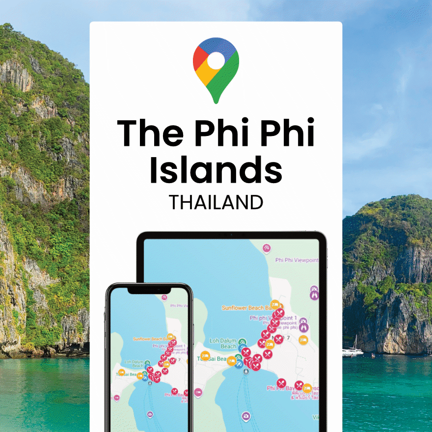
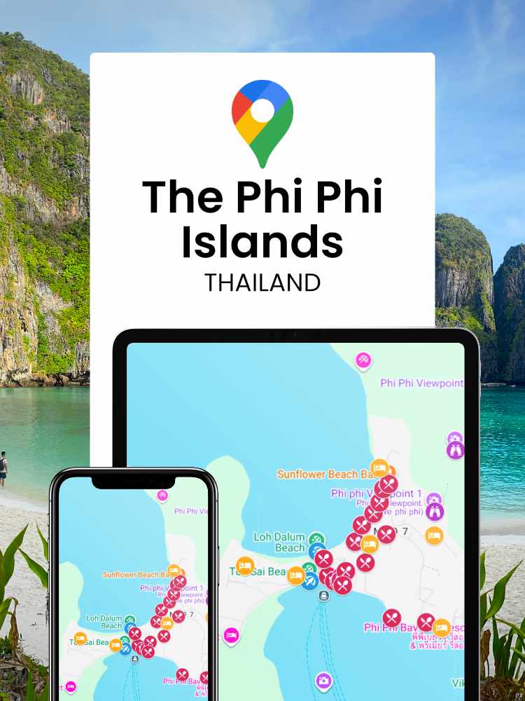
In my Phi Phi islands map you’ll find 50+ pins marking the best beaches, snorkeling spots and viewpoints, where to stay, eat and drink for every budget, and the practical stuff that saves you time during your trip — the ferry pier, the hospital, 7-Eleven and more.
Use the map layers to filter by category:
- beaches
- viewpoints
- restaurants and bars
- accommodation
- diving, snorkeling and boat tours
- practical info.
Don’t forget to save the map to your Google Maps app so that it works offline.
The map can be accessed without an account via a web browser.
For more tips on visiting Koh Phi Phi you can find the full length, written Koh Phi Phi guide on Global Gallivanting.
Map by Anna — Global Gallivanting
Reviews
There are no reviews yet.